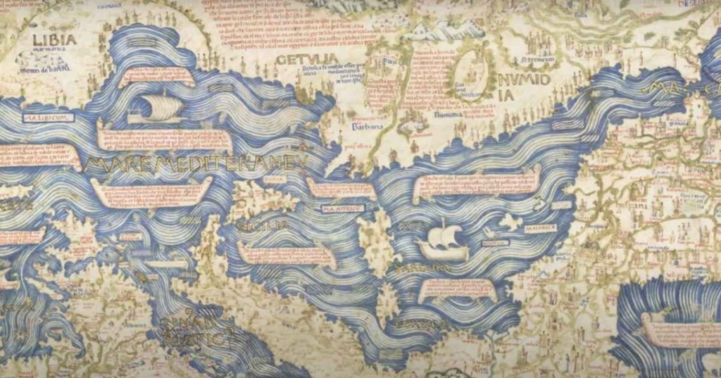
Today, billions of people use Google Maps to explore the world and find anything from a coffee shop to a bookstore. But 550 years ago, when people had nothing, an Italian cartographer named Fra Mauro set out to design the world map. What he ended up creating came to be known as one of the greatest and most accurate maps at the time, per Atlas Obscura. The map, known as “Mappa Mundi,” was the “Google Earth of the 15th century,” and is equally relevant in the present day.
Mauro was born around 1400. Famous for his cartographic skills, he traveled on merchant and military ships. He eventually converted to a monk at the Monastery of St. Michael, in the Camaldolese order residing on the Venetian island of Murano. There, he was commissioned by King Alfonso V of Portugal to create a world map. So, he set to work.
After scrupulous investigation and meticulous craftwork, he came out with a long-drawn-out, eight-foot by eight-foot map of the world he knew. Mappa Mundi (World Map) bore the date stamp of 26 August 1460. “It’s the oldest surviving medieval map,” Meredith Francesca Small, author of the book “Here Begins the Dark Sea,” told BBC, adding that it is the most complete medieval map to survive into modernity. “It’s the first map to be based on science more than religion.”
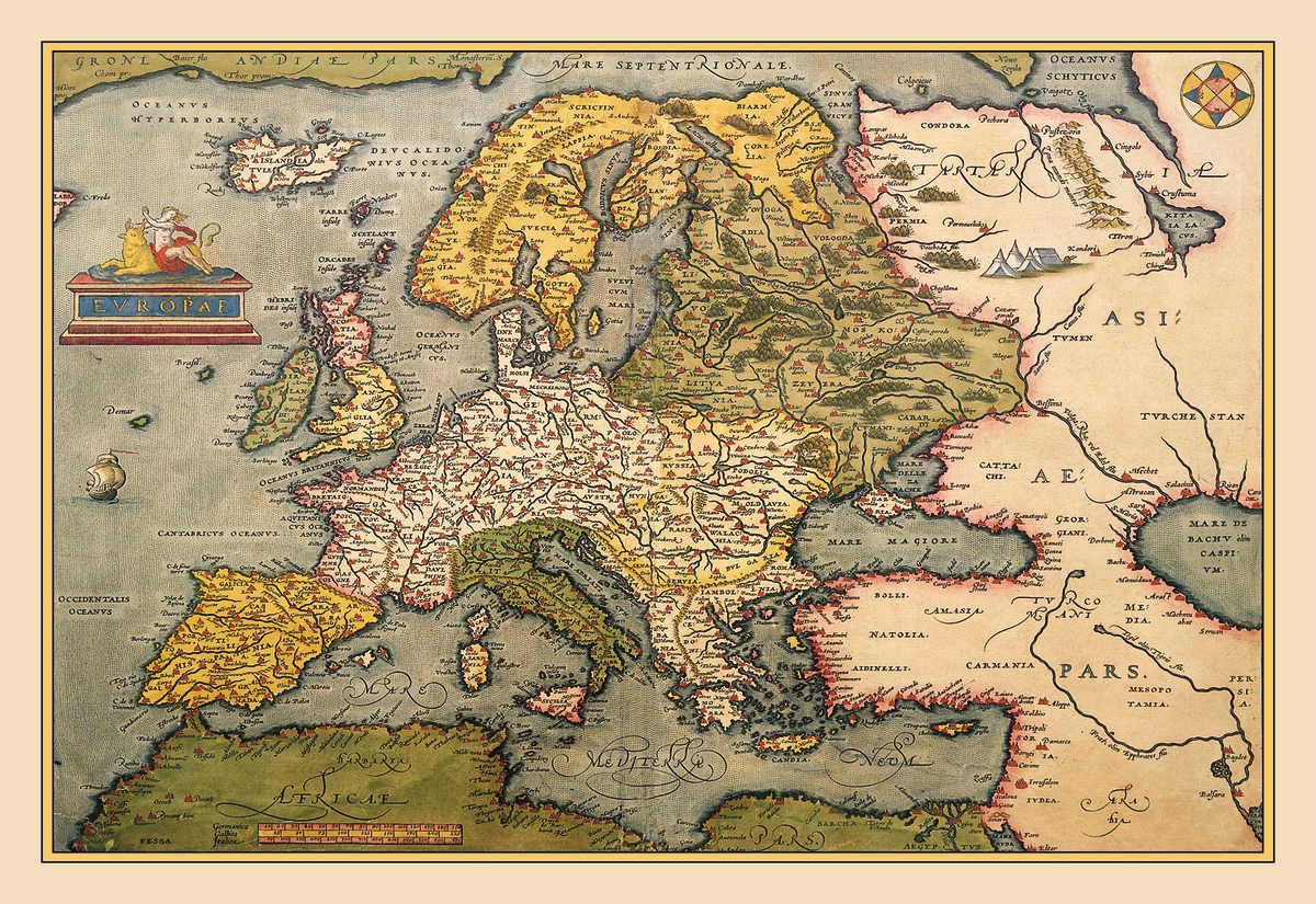
Representative Image Source: CIRCA 1602: Map of Europe (Photo by Buyenlarge/Getty Images)
The elaborate map is a splendid golden and blue painting ornamented with gorgeous drawings of palaces, bridges, sailing ships, rolling blue waves, exotic animals, seven-headed Indian serpents, troglodytes, and gold lakes. The map features over 3,000 locations across Africa, Europe, and Asia, with scribbles written in ancient Venetian that illustrate the stories, anecdotes, and legends of that time.
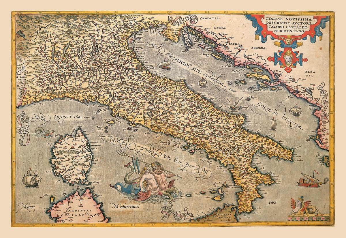
Representative Image Source: CIRCA 1602: Map of Italy (Photo by Buyenlarge/Getty Images)
He received the information for many of these illustrations from explorers, travelers, and Arab traders who passed through the town. Adding to it, the fall of Constantinople had a great influence on Venice. Refugees, who traveled to the city, were more than willing to exchange the tales of their journey for hunks of bread and pitchers of drinks. Mauro saw his opportunity.
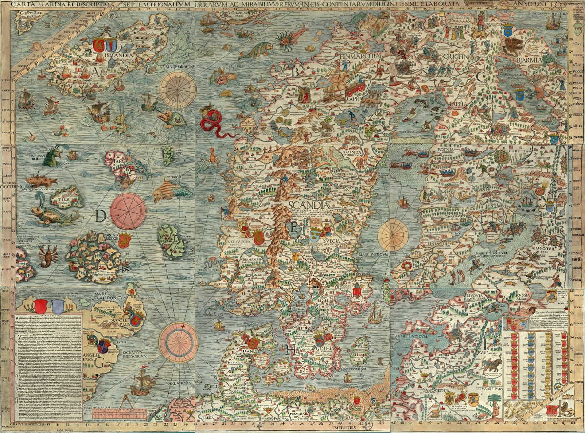
Representative Image Source: One of the oldest known maps of the Scandinavian countries and the region around the Baltic Sea. (Photo by VCG Wilson/Corbis via Getty Images)
For days and months, he would talk with these travelers, inquiring from them their accounts of travels, while simultaneously researching the facts in his monastery’s library, in the lagoon backwaters. He would ask them what they saw, what kind of animals they came across, the sights and the smells, and all. People swapped stories with him about honey-wine lakes and surreal monsters. Despite the limited information he had, Mauro never went into the mythical or religious realm to craft his map. He was skeptical of religious beliefs.
Atlas Obscura explains that Mauro’s map is accurate enough to guide researchers to various archaeological sites in the present day. For instance, Mauro accurately portrayed places like the Awash River, mountain ranges surrounding Addis Ababa, and the Ziquala mountain and a monastery that still exists almost five centuries later. The magnificent Mappa Mundi is currently showcased in the Biblioteca Marciana (Library of Saint Mark), Venice, as per BBC.
Today the world of Egyptology faces a silent crisis – not of looting, although that plays a part, but of disconnection. Walk into any major museum, from Copenhagen to California, and you see glass cases filled with what could be called orphaned artifacts: remarkable objects, often acquired in the 19th and early 20th century, that have been completely stripped of their histories. You can see what they are – a mummy’s painted foot case, a golden mask – but we have no idea where they came from. They are beautiful, but historically they are mute.
Many objects entered museum collections at times when excavation and collecting practices were very different from today. In the past, excavated objects were often divided between institutions around the world, and display was prioritized over documentation. Over time, connections between pieces were lost. As a result, museums around the world hold remarkable artifacts whose backstories are thin, fragmentary or missing altogether.
Archaeologists like me working in the field today regularly uncover fragments: broken pieces of objects that once formed part of something larger. In some cases, those fragments may share the same underlying geometry with objects already held in museums. For example, a mummy’s foot case and a newly found shard may have been produced using the same mold, so they share a consistent three-dimensional form even if they are now separated by time, distance and absence of documentation.
Traditionally, evaluating whether a fragment matches up with a specific museum object has relied on visual judgment and incomplete records, rather than a quantitative comparison of shape.
This gap between excavation archaeology and museum collections is one of the most persistent challenges in the field. My research asks a simple question: Can we use digital tools to test whether fragments and museum objects might be related and, in doing so, recover parts of their histories that were previously inaccessible?
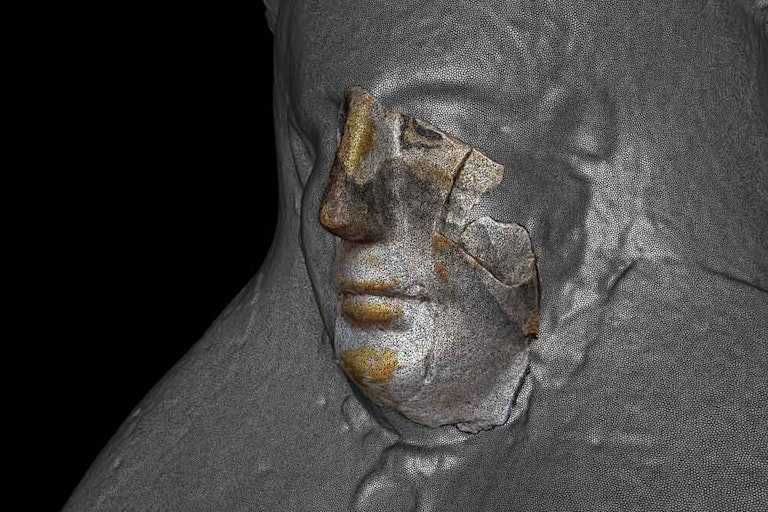
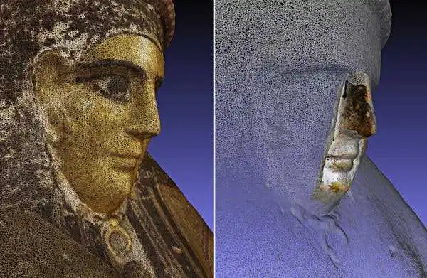
Reuse over time and looting shifted and damaged the contents of an ancient Egyptian tomb. This displaced mummy mask could have a relationship to other artifacts already in museums around the world. Carlo Rindi Nuzzolo
A long-standing problem in archaeology
Archaeology is, by nature, fragmentary. Objects break, decay or are disturbed over centuries. Traditionally, archaeologists have relied on visual inspection, stylistic comparison and written records to propose connections between fragments and objects. These approaches are still essential, but they also have limits. Visual judgments can be subjective, and archival documentation is often incomplete or inconsistent.
As a result, many potential links between excavated material and museum artifacts have remained speculative or have never been proposed at all. An object in a museum may appear complete yet still have a fragmented history. Without a way to test relationships systematically, fragments often remain sidelined as secondary or uninformative.
More than a century ago, the archaeologist Flinders Petrie argued that an object’s value lies not in its beauty but in the information it carries. An unremarkable fragment with a known history, he believed, could be more important than a finely made object without one. Today, digital tools are giving archaeologists new ways to put that idea into practice.
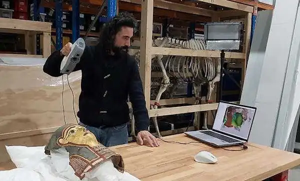
Archaeologists can use handheld 3D scanners to noninvasively map objects in very fine detail. Carlo Rindi Nuzzolo
Turning objects into data that can be compared
One of those tools is 3D scanning. Using portable scanners, it is now possible to capture the full surface geometry of an object with high precision, without touching or damaging it. Every curve, contour and variation in thickness can be recorded digitally.
Once scanned, an artifact becomes more than an image. It becomes data: a detailed digital model that can be rotated, measured, compared and analyzed. Importantly, this process is noninvasive. Fragile objects do not need to be moved, dismantled or physically tested.
For archaeologists and museum curators, this process opens up new possibilities. Objects held in different institutions, or fragments stored in excavation archives, can be compared digitally, even if the originals never leave their locations.
Scanning is only the first step. The real challenge lies in comparison. Rather than asking whether two pieces look similar, computational shape analysis allows researchers to ask a more precise question: How similar are their shapes?
In simple terms, the computer compares the geometry of two surfaces. It looks at curvature, thickness and spatial relationships, measuring how closely one surface matches another. It’s like comparing a kind of geometric fingerprint.
This approach doesn’t replace expert judgment. Instead, it supports it by providing measurable evidence that can confirm, refine or challenge visual impressions. It allows archaeologists to move from intuition to testing.
When a fragment meets a museum object
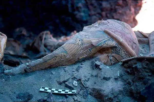
In a recent study published in the journal Heritage Science, I applied these methods to Graeco-Roman Egyptian funerary artifacts made of cartonnage, a composite material of linen, plaster and paint.
I created high-resolution 3D scans of excavated cartonnage fragments and compared them with an intact funerary mask held in a museum collection. The goal was not to reconstruct the object physically but to test whether their shapes were compatible in meaningful ways.
The comparison focused on three-dimensional geometry rather than decoration. This matters because cartonnage masks were often shaped in molds: If two objects were formed in the same mold, they can share highly consistent curvature and thickness patterns even when their painted surfaces differ.
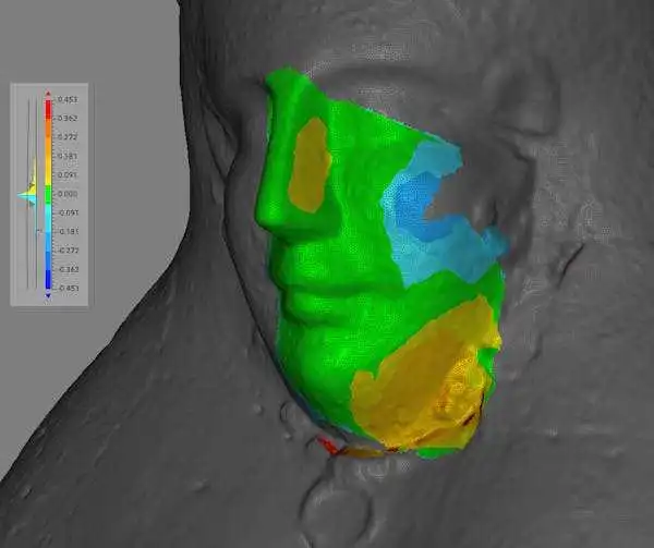
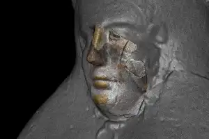
The mask reference surface is shown in gray, while the aligned fragment is colored based on the surface-to-surface distance at each point. Green indicates a good match with almost no distance. Cooler colors show areas where the fragment lies below the reference mask, and warmer colors show where it lies above. Carlo Rindi Nuzzolo
I used a distance-mapping approach called deviation mapping. After aligning the 3D model of an excavated fragment to the corresponding region of the intact museum object, the algorithm calculates the distances between the two surfaces at thousands of points. Areas where the distances were consistently small are geometrically very similar. Areas with consistently larger distances indicate that the fragment’s shape diverges from the reference surface.
In this case, the surfaces corresponded closely, with differences generally of less than a millimeter – a level of agreement consistent with production in the same mold rather than a coincidental visual resemblance.
What mattered most was not a single “match” but the ability to evaluate relationships transparently and reproducibly, using shared digital evidence.
One of the most powerful aspects of this approach is that it works across distance. Researchers can easily share digital models, allowing them to compare fragments and objects held in different institutions, without transporting fragile artifacts. Excavation archives, museum collections and research institutions can begin to speak the same digital language, reconnecting evidence that has long been separated by geography and history.
The work I describe here, part of my recent CRAFT Project, does not use artificial intelligence or machine learning. It relies on computer-based shape comparison and careful interpretation of metrological results. But it sits within a broader movement in heritage research.
Across the world, researchers and institutions are beginning to combine 3D scanning with machine learning to explore collections in different ways. For example, the EU-funded RePAIR project uses AI and robotics to help reassemble fragmented archaeological artifacts, while major institutions such as the Smithsonian are experimenting with AI-driven analysis of large 3D collections.
Together, these projects point to a future in which digital tools play an increasingly active role in how museums and archaeologists understand the past.
Digital archaeology is sometimes associated with flashy reconstructions or virtual displays. But its deeper value lies elsewhere. By giving fragments a new analytical role, digital methods allow archaeologists to recover relationships that were long thought irretrievably lost.
New digital methodologies are breathing new life into a long-standing archaeological principle: Modest fragments can carry outsized significance when they clarify an object’s origins and its lost context, finally allowing it to find its way back home.
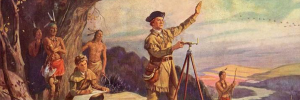
Photo credit: Henry Hintermeister/Public domain via Wikimedia Commons – A young George Washington was thrust into the dense, contested wilderness of the Ohio River Valley as a land surveyor for real estate development companies in Virginia.
This Presidents Day, I’ve been thinking about George Washington − not at his finest hour, but possibly at his worst.
In 1754, a 22-year-old Washington marched into the wilderness surrounding Pittsburgh with more ambition than sense. He volunteered to travel to the Ohio Valley on a mission to deliver a letter from Robert Dinwiddie, governor of Virginia, to the commander of French troops in the Ohio territory. This military mission sparked an international war, cost him his first command and taught him lessons that would shape the American Revolution.
As a professor of early American history who has written two books on the American Revolution, I’ve learned that Washington’s time spent in the Fort Duquesne area taught him valuable lessons about frontier warfare, international diplomacy and personal resilience.
The mission to expel the French
In 1753, Dinwiddie decided to expel French fur trappers and military forces from the strategic confluence of three mighty waterways that crisscrossed the interior of the continent: the Allegheny, Monongahela and Ohio rivers. This confluence is where downtown Pittsburgh now stands, but at the time it was wilderness.
King George II authorized Dinwiddie to use force, if necessary, to secure lands that Virginia was claiming as its own.
As a major in the Virginia provincial militia, Washington wanted the assignment to deliver Dinwiddie’s demand that the French retreat. He believe the assignment would secure him a British army commission.
Washington received his marching orders on Oct. 31, 1753. He traveled to Fort Le Boeuf in northwestern Pennsylvania and returned a month later with a polite but firm “no” from the French.
Dinwiddie promoted Washington from major to lieutenant colonel and ordered him to return to the Ohio River Valley in April 1754 with 160 men. Washington quickly learned that French forces of about 500 men had already constructed the formidable Fort Duquesne at the forks of the Ohio. It was at this point that he faced his first major test as a military leader. Instead of falling back to gather more substantial reinforcements, he pushed forward. This decision reflected an aggressive, perhaps naive, brand of leadership characterized by a desire for action over caution.
Washington’s initial confidence was high. He famously wrote to his brother that there was “something charming” in the sound of whistling bullets.
The Jumonville affair and an international crisis
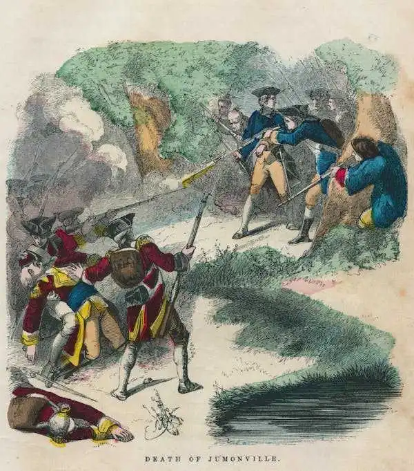
Perhaps the most controversial moment of Washington’s early leadership occurred on May 28, 1754, about 40 miles south of Fort Duquesne. Guided by the Seneca leader Tanacharison – known as the “Half King” – and 12 Seneca warriors, Washington and his detachment of 40 militiamen ambushed a party of 35 French Canadian militiamen led by Ensign Joseph Coulon de Jumonville. The Jumonville affair lasted only 15 minutes, but its repercussions were global.
Ten of the French, including Jumonville, were killed. Washington’s inability to control his Native American allies – the Seneca warriors executed Jumonville – exposed a critical gap in his early leadership. He lacked the ability to manage the volatile intercultural alliances necessary for frontier warfare.
Washington also allowed one enemy soldier to escape to warn Fort Duquesne. This skirmish effectively ignited the French and Indian War, and Washington found himself at the center of a burgeoning international crisis.
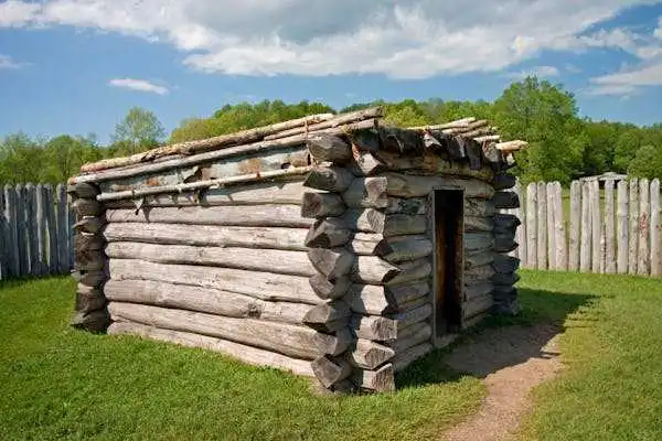
Defeat at Fort Necessity
Washington then made the fateful decision to dig in and call for reinforcements instead of retreating in the face of inevitable French retaliation. Reinforcements arrived: 200 Virginia militiamen and 100 British regulars. They brought news from Dinwiddie: congratulations on Washington’s victory and his promotion to colonel.
His inexperience showed in his design of Fort Necessity. He positioned the small, circular palisade in a meadow depression, where surrounding wooded high ground allowed enemy marksmen to fire down with impunity. Worse still, Tanacharison, disillusioned with Washington’s leadership and the British failure to follow through with promised support, had already departed with his warriors weeks earlier. When the French and their Native American allies finally attacked on July 3, heavy rains flooded the shallow trenches, soaking gunpowder and leaving Washington’s men vulnerable inside their poorly designed fortification.
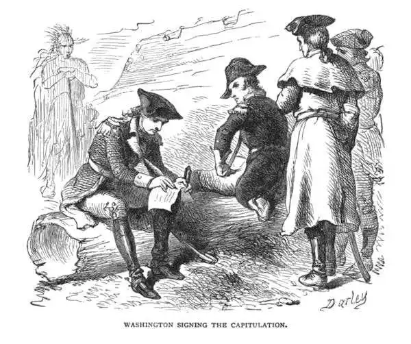
The battle of Fort Necessity was a grueling, daylong engagement in the mud and rain. Approximately 700 French and Native American allies surrounded the combined force of 460 Virginian militiamen and British regulars. Despite being outnumbered and outmaneuvered, Washington maintained order among his demoralized troops. When French commander Louis Coulon de Villiers – Jumonville’s brother – offered a truce, Washington faced the most humbling moment of his young life: the necessity of surrender. His decision to capitulate was a pragmatic act of leadership that prioritized the survival of his men over personal honor.
The surrender also included a stinging lesson in the nuances of diplomacy. Because Washington could not read French, he signed a document that used the word “l’assassinat,” which translates to “assassination,” to describe Jumonville’s death. This inadvertent admission that he had ordered the assassination of a French diplomat became propaganda for the French, teaching Washington the vital importance of optics in international relations.
The 1754 campaign ended in a full retreat to Virginia, and Washington resigned his commission shortly thereafter. Yet, this period was essential in transforming Washington from a man seeking personal glory into one who understood the weight of responsibility.
He learned that leadership required more than courage – it demanded understanding of terrain, cultural awareness of allies and enemies, and political acumen. The strategic importance of the Ohio River Valley, a gateway to the continental interior and vast fur-trading networks, made these lessons all the more significant.
Ultimately, the hard lessons Washington learned at the threshold of Fort Duquesne in 1754 provided the foundational experience for his later role as commander in chief of the Continental Army. The decisions he made in Pennsylvania and the Ohio wilderness, including the impulsive attack, the poor choice of defensive ground and the diplomatic oversight, were the very errors he would spend the rest of his military career correcting.
Though he did not capture Fort Duquesne in 1754, the young George Washington left the woods of Pennsylvania with a far more valuable prize: the tempered, resilient spirit of a leader who had learned from his mistakes.
But as a geographer and specialist in geographic information systems, I have observed how opportunities for women as mapmakers have changed over the past five decades. The advent of technologies such as geographic information systems has increased education, employment and research opportunities for women, making mapmaking more accessible.
The female landscape
Women have long been essential to how people see and understand the world. The concept of Mother Earth or Mother Nature as the center of the universe and source of all life spans Indigenous cultures around the globe.
In the 20th century, the scientific community and environmental activists adopted the term Gaia – the Greek goddess personifying the Earth, the mother of all deities – to reflect the notion of the Earth as a living system. Gaia is represented as female and understood as a guiding force in maintaining the atmosphere, oceans and climate.
The representation of land as woman was reshaped with the rise of nationalism when the terms “fatherland” and “motherland”took on distinct meanings. Fatherland implied heritage and tradition, while motherland suggests place of birth and sense of belonging. These gendered constructs appear across cultures.
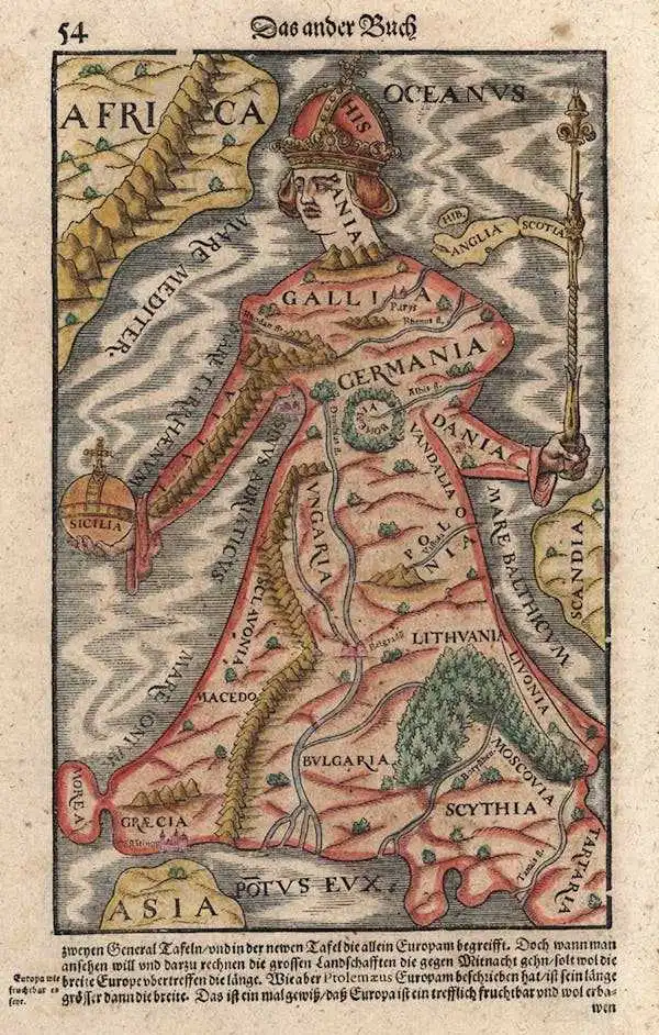
Another aspect of the gendered nature of cartography is the way maps used female forms to portray features. Anthropomorphic maps from the 16th through 19th centuries demonstrate how cartographers used female figures to depict European countries. For example, cartographer Johannes Putsch’s “Europa Regina,” originally drawn in 1537, set the template for later maps in which nations are depicted as women in various poses and different states of dress – or undress – though they don’t actually correspond closely to the actual shapes of real landforms.
These maps reflect shifting cultural and political meanings attached to territory and power. The female landscape, or woman as map, is often used to portray countries as active, aggressive or supine, depending upon the status of the nation state in relation to war and peace and the stereotypes of a country.
Technology and women’s roles in mapmaking
While the technical contributions women have made to mapping span the entire history of cartography, they are difficult to identify and document. But a closer look reveals the variety of roles women have played in mapmaking.
One of the earliest known examples of a map made by a woman dates to the fourth century, when the sister of the prime minister of the Han Dynasty in China embroidered a map on silk.
During the 15th and 16th centuries, women were employed to color maps and contribute artistic details to borders. Many women cartographers used only a first initial and last name, obscuring their gender and making their work difficult to trace.
The 18th century brought the advent of printing, which opened new avenues for women to participate as engravers of copper plates, publishers of maps, and globemakers.
By the 19th century, cartography became part of formal education for women in North America, where the intersection of embroidery and geography produced fabric globes and linen maps. This was later followed by drawing and coloring maps as access to paper and pencils improved.
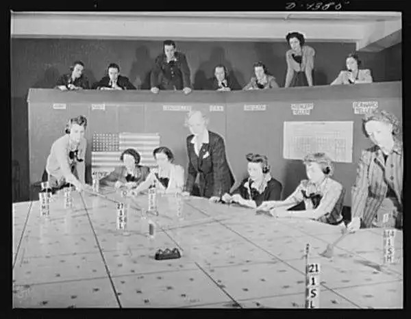
World War II ushered in a new era of opportunity for women in the U.S., as they were recruited to fill critical roles in cartographic development while men were sent to war. Known as Millie the Mapper or the Military Mapping Maidens, women produced topographic maps, interpreted aerial photography and helped advance photogrammetry, the use of photos to make 3D models of the Earth’s topography.
Women have also overseen the creation of maps in a number of ways.
Indigenous matriarchal societies expressed spatial information through different forms of cartography. These includes songs, dances and rituals that identified important communal resources such as springs, sacred groves and migration paths.
The development of European cartography was driven by the Age of Exploration from the 15th to 17th centuries and entrepreneurial activities associated with reproducing and selling maps. Women often assumed these roles after the deaths of their husbands, ensuring the continuation of family businesses.
Not only kings but queens also directed what maps were needed. For example, Queen Elizabeth I commissioned the 1579 Atlas of England and Wales, one of the first national atlases. It rendered a map of the entire country, accessible from home or a reading room.
Women setting the direction of maps
While early maps positioned women primarily as symbolic bodies to project political meaning or as supporters of larger mapping enterprises, contemporary cartography reveals a different dynamic between gender and maps: There is a lack of geographic data on issues affecting women, including health, safety and planning for the future.
For example, women are disproportionately affected by disasters, including through a heightened risk of experiencing gender-based violence. Geographic analyses reveal a persistent gender gap in datasets, which often lack information on women’s health and daily needs, reproductive services or child care centers.
Studies have shown that the development of geospatial technologies and open mapping platforms are dominated by men. In situations such as disasters, having a diversity of perspectives in mapmaking is essential to serving the needs of the community.
Creating maps that specifically reflect women’s needs is foundational for women to fully participate in 21st-century mapmaking. In the past decade, several programs and organizations have been working to reflect women’s contributions to cartography and demonstrate how collective action can make a difference.
For example, African Women in GIS hosts workshops to elevate women’s perspectives and mapping needs, putting mobile mapping technology in women’s hands. GeoChicas and YouthMappers’ Let Girls Map empower women to make maps through training and education that address the digital divide. Women in GIS and Women+ in Geospatial build community in mapmaking through professional networks. Humanitarian OpenStreetMap Team amplifies women’s voices to inform geospatial approaches to mapmaking and empowering women’s mapmaking contributions.
Never have there been more opportunities for women to participate in mapmaking, and never has women’s role in mapmaking been as important to address the intractable issues societies face around the world.


